An aerial view of the highway to Medog, southwest China's Tibet Autonomous Region, March 30, 2017 (Xinhua/Purbu Tashi)
China's last isolated county was connected to the national road network when a highway to Medog County was built in Tibet in 2013.

An aerial view of a highway in Medog, southwest China's Tibet Autonomous Region, March 30, 2017 (Xinhua/Purbu Tashi)
The road with a total investment of 950 million yuan (about 155 million U.S. dollars) stretches through hidden paths in primeval forests, tunnels under snow-covered mountains and bridges over big rivers.

An aerial view of a highway in Medog, southwest China's Tibet Autonomous Region, March 30, 2017 (Xinhua/Purbu Tashi)
The road is accessible for eight to nine months per year, bar major natural disasters.

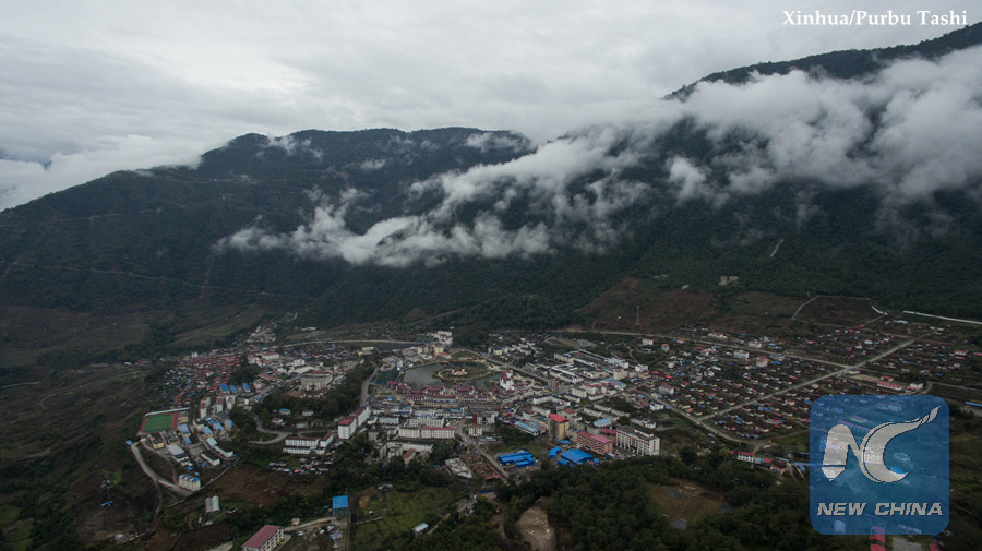
An aerial view of Medog County in southwest China's Tibet Autonomous Region, March 30, 2017 (Xinhua/Purbu Tashi)
Near China's border with India, Medog locates in the downstream of the Yarlung Zangbo River and south of the Himalayas. Its name means the "secret lotus" in Tibetan. And as the name suggests, it is a beautiful place surrounded by snow-capped mountains. It used to be known as China's last and only county without a highway link.

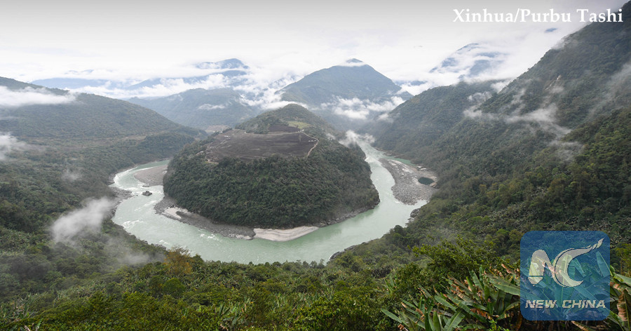
A U-turn of the Yarlung Zangbo River in southwest China's Tibet Autonomous Region, March 30, 2017 (Xinhua/Purbu Tashi)
The county is quite different from other areas in Tibet in terms of both scenery and weather. Surrounded by mountains, it is humid and rich in resources.

Medog residents in a banana plantation in southwest China's Tibet Autonomous Region, March 30, 2017 (Xinhua/Purbu Tashi)
Medog's breath-taking scene had attracted visitors around the world even before the road was built. Its hiking paths through mountains are famous among backpackers.

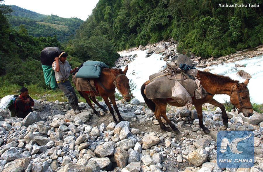
People have to trek on rugged paths to carry in and out goods in Medog, southwest China's Tibet Autonomous Region before the road was built. Photo taken on Oct. 19, 2004. (Xinhua/Purbu Tashi)
But reaching Medog used to be a dangerous journey. People had to climb over Galung La and Doxong La, two snow-capped mountains rising over 4,000 meters above sea level. During the journey, there were frequent accidents such as landslides and collapses.

Vehicles pass a waterfall on the highway to Medog in southwest China's Tibet Autonomous Region, March 30, 2017. (Xinhua/Purbu Tashi)
Rugged mountain paths were once the only travel routes in Medog. Complicated geological conditions and frequent natural disasters had thwarted seven previous attempts to build a highway in the area since the 1960s.

Bridges to Medog in southwest China's Tibet Autonomous Region before the road was built. Photo taken on Oct. 19, 2004. (Xinhua/Purbu Tashi)
Local people called the rugged way "monkeys' path," as only people who were light and flexible like monkeys could make their way out of the mountains.

People have to trek on rugged paths to carry in and out goods in Medog, southwest China's Tibet Autonomous Region before the road was built. Photo taken on Oct. 19, 2004. (Xinhua/Purbu Tashi)
A makeshift road dug along cliffs was built in 1994, but was only accessible between July and September, with frequent fatal traffic accidents.

An aerial view of the highway to Medog in southwest China's Tibet Autonomous Region, March 30, 2017 (Xinhua/Purbu Tashi)
The building of the new road was approved by the State Council, China's cabinet, in 2008. Work officially began in April 2009.

Medog children in a grocery store in southwest China's Tibet Autonomous Region, March 30, 2017 (Xinhua/Purbu Tashi)
The opening of the Medog road has greatly lowered transportation costs and commodity prices. It has also brought in opportunities for the locals and helped in poverty relief.
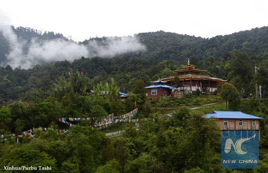
A temple in Medog, southwest China's Tibet Autonomous Region, March 30, 2017 (Xinhua/Purbu Tashi)
In 2016, over 70,000 tourists visited Medog, double the amount before the road went into operation in 2013. Most local residents now go in for tourism and transportation businesses.

