


China's Five-hundred-meter Aperture Spherical radio Telescope (FAST) in southwest China's Guizhou Province, on Aug. 27, 2019. China's FAST, the world's largest single-dish radio telescope, will greet the third anniversary of operation that began in September 2016. (Xinhua/Ou Dongqu)
Fly over China towards the future.
BEIJING, Jan. 1 (Xinhua) -- From above, the world reveals itself in an unfamiliar but impressive way, adding a dimension to our understanding of life.
Drones, the wings of the eyes and eyes of the explorers, take us to recap the year of 2019, with the most notable aerial shots from Xinhua photographers

Aerial photo taken on July 24, 2019 shows the China Spallation Neutron Source (CSNS), China's first research facility providing the most intense pulsed neutron beams for scientific research, at Dalang Town in Dongguan, south China's Guangdong Province. Friday marked CSNS's first anniversary of being put into operation after it passed the national acceptance test. (Xinhua/Liu Dawei)

Aerial photo taken on Oct. 23, 2019 shows heliostats of a molten-salt solar thermal power plant in Dunhuang, northwest China's Gansu Province. (Xinhua/Ma Ning)

Aerial photo shows China's spacecraft tracking ship Yuanwang-3 sailing on the southern Pacific Ocean, June 21, 2019. (Xinhua/Li Yuze)
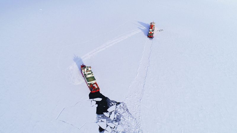
Aerial photo taken on Dec. 1, 2019 shows China's icebreakers Xuelong and Xuelong 2 at an area close to China's Zhongshan Station in Antarctica. (Xinhua/Liu Shiping)
Aerial photo taken on March 16, 2019 shows workers watering saplings of sacsaoul trees in Alxa Right Banner, north China's Inner Mongolia Autonomous Region. As temperature rises, people plant sacsaoul trees at desert to prevent and control desertification in Alxa Right Banner. A total of 380,000 mu (about 25,333 hectares) of sacsaoul trees will be planted in Alxa Right Banner in a month. (Xinhua/Yu Dongsheng)
Aerial photo taken on Jan. 18, 2019 shows the snow cover in Zhaosu County, northwest China's Xinjiang Uygur Autonomous Region. A nine-member research team with an average age under 30 from the Xinjiang Institute of Ecology and Geography under the Chinese Academy of Sciences started a research on snow cover on the Tianshan Mountains in Xinjiang. Snow cover on the Tianshan Mountains is an important source of water resources. Snowmelt provides an abundant water supply for river flow in this area and also affects the ecological system of agricultural and animal husbandry production in the downstream oasis. (Xinhua/Hu Huhu)
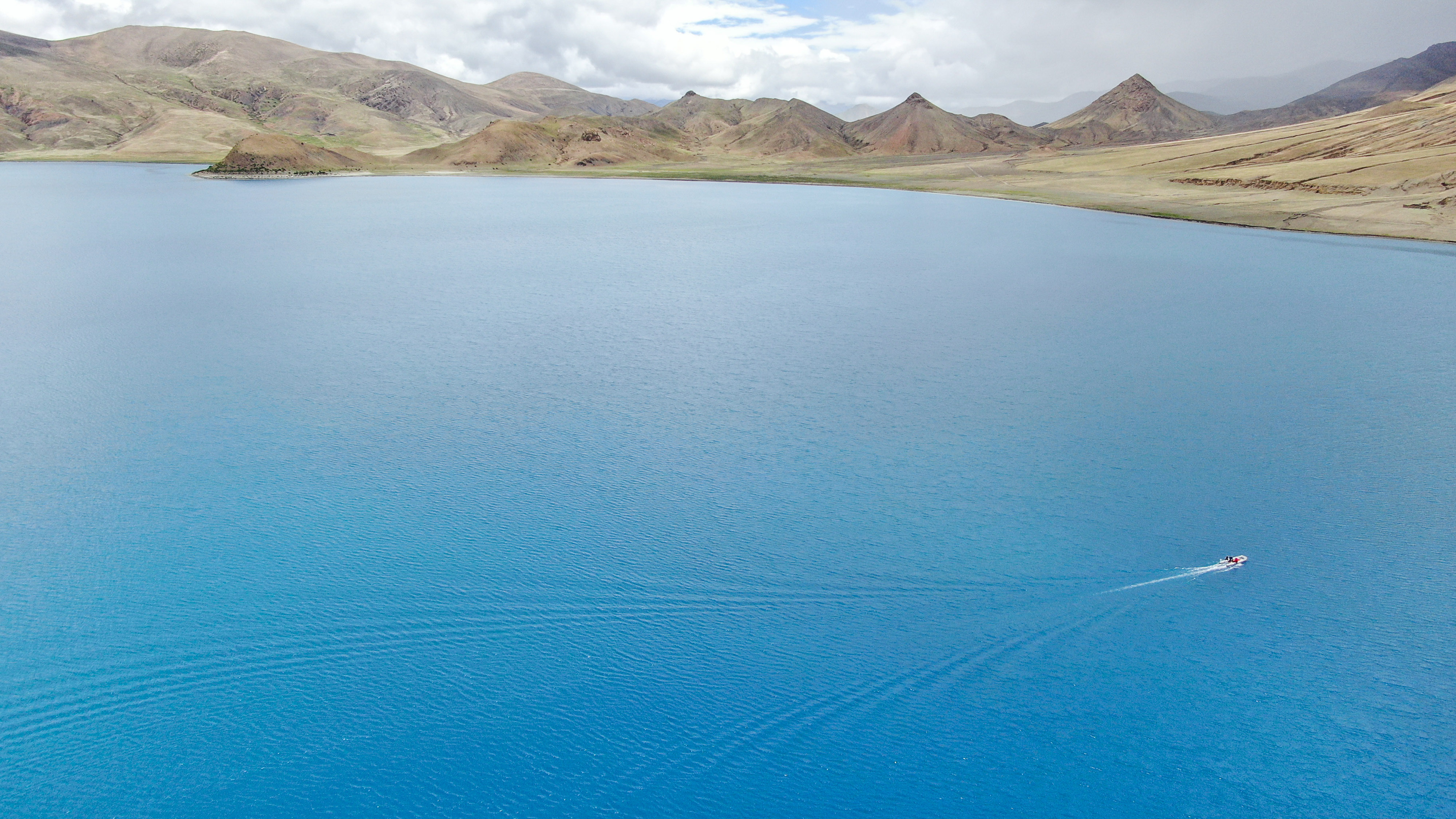
Aerial photo taken on July 22, 2019 shows a Chinese scientific expedition team taking a boat to the main area of Lake Yamzhog Yumco for survey in Nanggarze County of Shannan, southwest China's Tibet Autonomous Region. Chinese scientists are working on a survey to measure the depth of a major lake in southwest China's Tibet Autonomous Region, sources with the Chinese Academy of Sciences (CAS) said Tuesday.
Lake Yamzhog Yumco with an area of about 590 square km is located in Nanggarze County in the city of Shannan. Yamzhog Yumco along with Lake Namtso and Lake Manasarovar are regarded as the three holy lakes of Tibet. (Xinhua/Jigme Dorje)
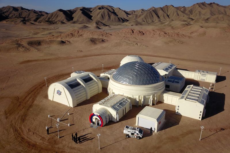
Aerial photo taken on April 17, 2019 shows the simulated "Mars Base 1" in Jinchang City of northwest China's Gansu Province. The simulated Mars base, opened on Wednesday in Gansu, was aimed at popularizing science and boosting interest in space exploration. (Xinhua/Fan Peishen)
