


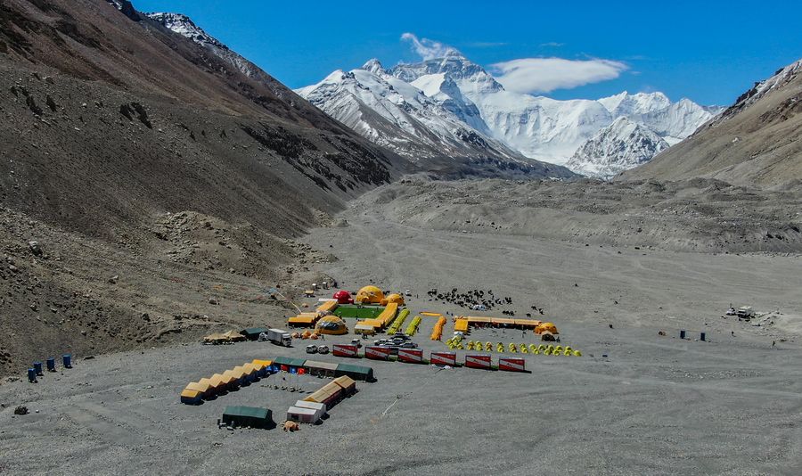
Aerial photo taken on April 28, 2020 shows the Mount Qomolangma base camp in southwest China's Tibet Autonomous Region. (Xinhua/Jigme Dorje)
"From 1715 to 1717, Chinese surveyors used scientific methods for surveying and marked the mountain on the map," said a paper published in 1958.
MOUNT QOMOLANGMA BASE CAMP, May 5 (Xinhua) -- Historical records and surveying instruments show that Chinese researchers were the first to conduct surveys at the world's highest mountain Qomolangma.
"Ethnic Tibetans living in the southern part of Tibet were the first to discover and name the mountain. From 1715 to 1717, Chinese surveyors used scientific methods for surveying and marked the mountain on the map," said Lin Chao, a late expert on geographic history and topography, in a paper published in 1958.
According to Lin's research, the name Qomolangma first appeared in Huang Yu Quan Lan Tu, or Atlas of the Whole Imperial Territory, in 1721. The map was made during the reign of Emperor Kangxi of the Qing Dynasty (1644-1911).
"Emperor Kangxi realized the importance of maps during warfare, but he also found that maps at the time did not correspond to reality, so he ordered that a new map was made," said Zhou Qian, a senior researcher with the Palace Museum in Beijing.
In 1715, the emperor sent surveyors to Tibet, and they carried what were the latest measuring instruments, said Zhou.
The instruments included a semi-circle protractor with four movable pointers, which represented the leading measuring technology at the time, said Zhou. The protractor is kept in the museum. Other museum exhibits, including a bronze quadrant, indicate that the surveyors who went to Tibet attempted height measuring, he said.
The 1715 survey was documented in several files including Qing Shi Gao (translated as Qing Dynasty Files), and Qing Shi Lu (translated as Factual Records of Qing Dynasty), though the imperial atlas is the most direct evidence, Zhou said.
In Lin's paper, he said the longitude and latitude information of Mount Qomolangma as shown on the atlas were different from modern results, but the relevant position is clear. The three branches of mountains shown on the map are the central, eastern and western Rongpo Glaciers today.
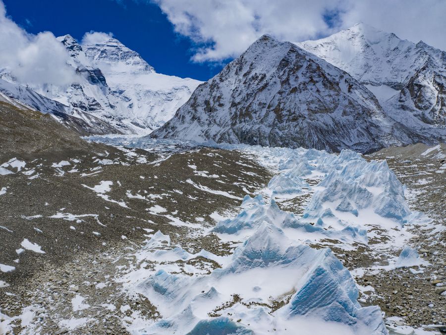
Aerial photo taken on April 30, 2020 shows the central Rongpo Glacier at the foot of Mount Qomolangma, southwest China's Tibet Autonomous Region. (Xinhua/Purbu Zhaxi)
Lin and Zhou's research countered narratives that Westerners were the first to survey the mountain straddling the border of China's Tibet and Nepal. In an 1850s survey, the mountain was named after George Everest, a British surveyor general of India who led a team in surveying the Himalayan ranges.
Zhou said it is regrettable that the height of the mountain was not shown on the map. "The full findings of the Qing Dynasty survey of the mountain have yet to be found in public files so far, but I believe as studies in this regard deepen, we may be able to find out about its height in the future," he said.
"The atlas is the earliest known document on the survey of Mount Qomolangma, which means that China's survey is about 140 years earlier than those by the West," said Zhou.
In the Tibetan language, Qomolangma represents the mother goddess. The mountain is known as Sagarmatha in Nepalese.
China on Thursday initiated a new round of measurement on the height of Mount Qomolangma. Its re-measurement of the mountain comes at a year that marks the 65th anniversary of the establishment of diplomatic relations between China and Nepal. It also marks the 60th anniversary of human beings reaching the summit of Mount Qomolangma via the north ridge, as well as the 45th anniversary of China accurately measuring and announcing the height of the peak for the first time. ■
