|
Location
 Brunei
Darussalam is situated on the north-west of the island of Borneo,
between east longitudes 114 degrees 04' and 11 degrees 23' and north
latitudes of 4 degrees 00' and 5 degrees 05'. It has a total area
of 5,765-sq. km. with a coastline of about 161-km along the South
China Sea. It is bounded on the North by the South China Sea and
on all the other sides by Malaysian State of Sarawak. Brunei
Darussalam is situated on the north-west of the island of Borneo,
between east longitudes 114 degrees 04' and 11 degrees 23' and north
latitudes of 4 degrees 00' and 5 degrees 05'. It has a total area
of 5,765-sq. km. with a coastline of about 161-km along the South
China Sea. It is bounded on the North by the South China Sea and
on all the other sides by Malaysian State of Sarawak.
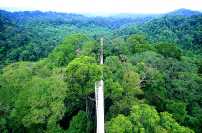
Physical Features
 The
land surface is developed on bedrock of tertiary age comprising
of sandstone, shale and clays. The terrain in the western part of
Brunei Darussalam is predominantly hilly lowland below 91 metres,
but rising in the hinterland to about 300 metres. The eastern part
of the state consists predominantly of rugged mountain terrain,
rising 1,850 metres above sea level at Bukit Pagon. The coast has
a wide, tidal and swampy plain. The
land surface is developed on bedrock of tertiary age comprising
of sandstone, shale and clays. The terrain in the western part of
Brunei Darussalam is predominantly hilly lowland below 91 metres,
but rising in the hinterland to about 300 metres. The eastern part
of the state consists predominantly of rugged mountain terrain,
rising 1,850 metres above sea level at Bukit Pagon. The coast has
a wide, tidal and swampy plain.
Climate
Brunei Darussalam has an equatorial climate characterized by a
uniform high temperature, high humidity and heavy rainfall. Temperatures
range from 23 - 32 Degree Celsius, while rainfall varies from 2,500
mm annually on the coast to 7,500 mm in the interior. There is no
distinct wet season.
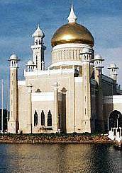
Capital and Town
 Brunei
Darussalam is divided into four districts namely Brunei/Muara, Tutong,
Belait and Temburong. Bandar Seri Begawan is the capital of Brunei
Darussalam with an area of about 16 sq. km. And a population of
about 46 thousands (1991 census) including Kampong Ayer (Water Village).
It is located in the Brunei/Muara District, and is the Centre of
government and business activities. Brunei
Darussalam is divided into four districts namely Brunei/Muara, Tutong,
Belait and Temburong. Bandar Seri Begawan is the capital of Brunei
Darussalam with an area of about 16 sq. km. And a population of
about 46 thousands (1991 census) including Kampong Ayer (Water Village).
It is located in the Brunei/Muara District, and is the Centre of
government and business activities.
Other towns are Muara, about 41 km to the north east of Bandar
Seri Begawan where the chief port is located, Seria which is the
seat of oil and gas industry, and Kuala Belait, Pekan Tutong and
Bangar which are the administrative centres of Belait, Tutong and
Temburong Districts respectively.
|